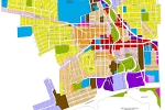
Land Use Planning Mapping
Laser scanning and photogrammetry are excellent resources for land planning. A virtual representation using a 3D point cloud captures everything you would normally see driving down a road. Mobile LiDAR data not only helps with planning the placement of landscape features, but it can be analyzed for the correct placement of features as well.
Laser scanned data can also reveal if the placement of landscape feature elements obstruct the view of drivers within a road or parking corridor. Through the combination of photogrammetric techniques and the cutting edge technology of 3D point cloud collection, ADS has the tools to satisfy both large and small land planning projects, whether they are new construction or existing design changes.