Government
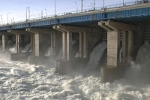
ADS has the ability to acquire water resource data from an aerial mission or from vehicular/watercraft platforms. No matter how difficult an area’s access, ADS has multiple tools to get the job done. ADS has experience with the Federal Emergency Management Agency (FEMA), the U.S. Army Corps of Engineers and many other federal, state, and municipal clients providing levee, watershed management, mine reclamation and flood plain assessment.